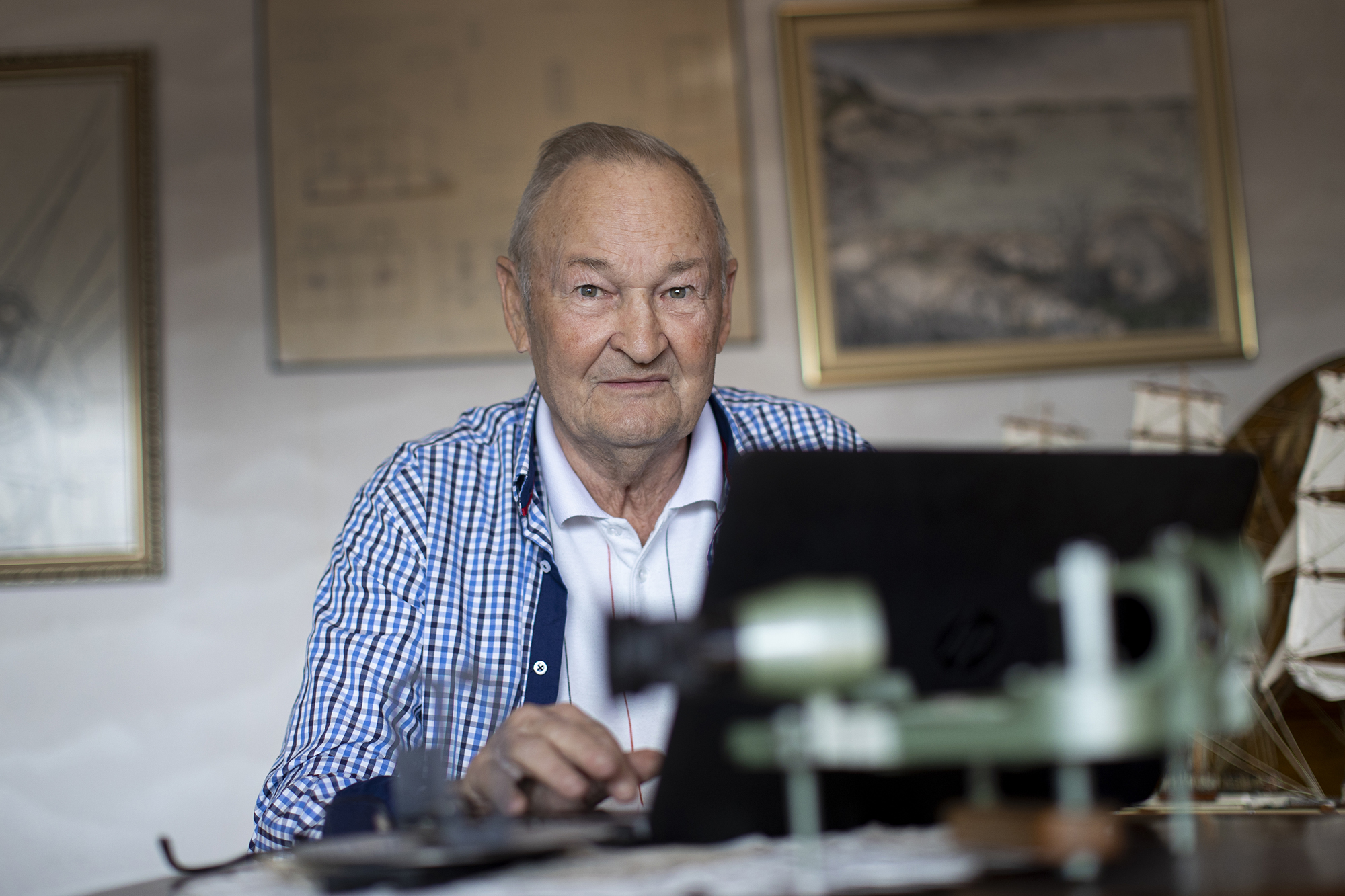
By Erik Nordlund
It is best to start by checking the facts from my Seaman’s Book. It was, after all, more than 50 years ago, as we are now living the year 2021. The evidence is found in the Seaman’s Book:
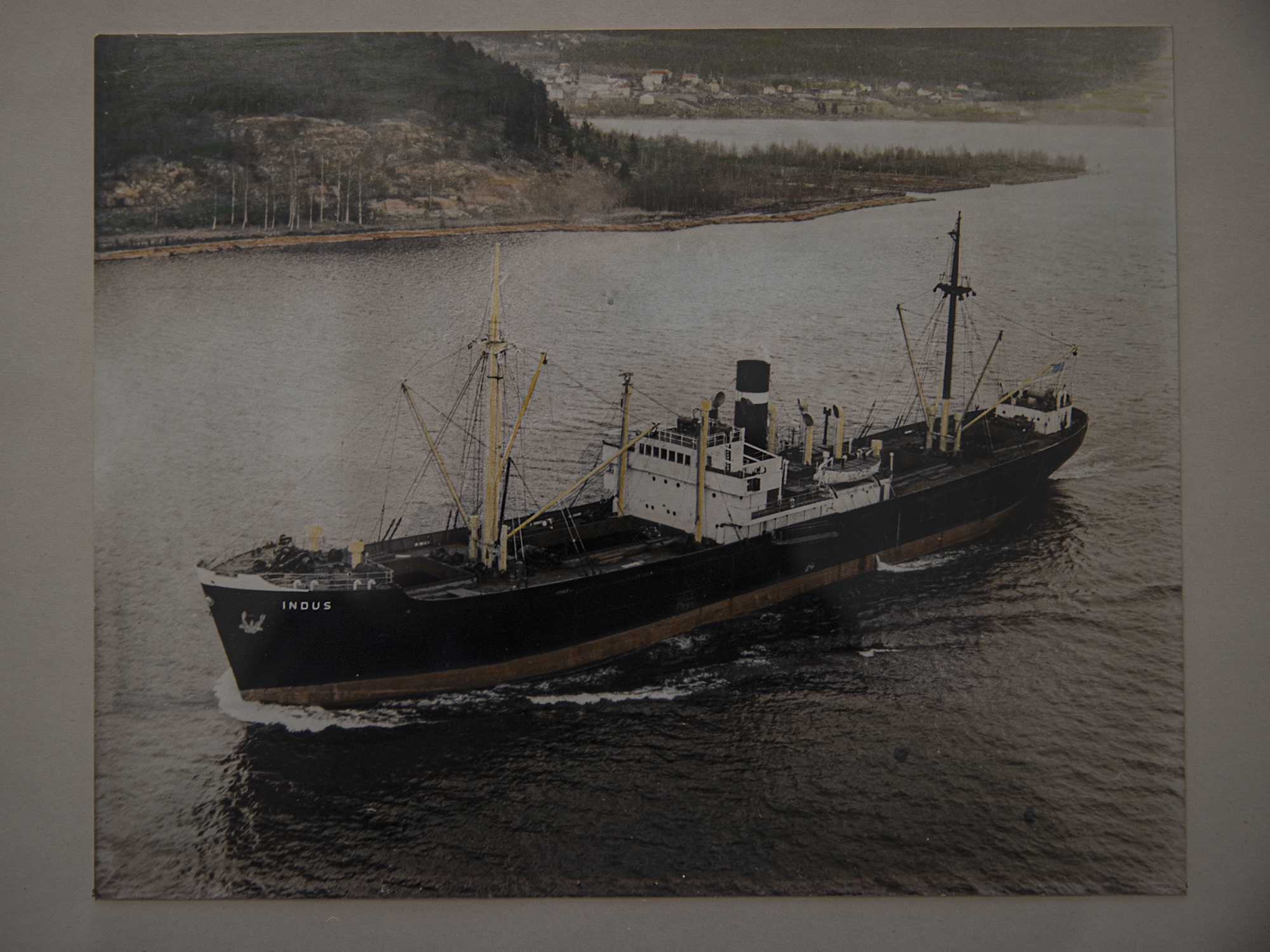
"Nordlund Erik Allan, b. 1940, has served on board s/s Indus, Mariehamn, OGJP, 2878 G.R.T., 1800 I.H.P., as the first mate during the following sailings: 30 January 1967–14 May 1967 European and Atlantic traffic. 14 May 1967 discharge at Vallvik. 15 May 1967 signature Bengt Johansson, Shipmaster.”
In the following, I will recall my own reminiscences from that dreadful journey across the Northern Atlantic that Ole Lundberg has written about in different contexts. Ole and I were fellow students at the Seamen’s School in Oslo (Oslo Sjømannsskole), and Ole served later at, for example, ATC and onboard the Archipelago ferries. At the end of the 1960s, we studied for the higher shipmaster (høyere skipsfører) diploma within the Commerce & Navigation programme at the Seamen’s School in Oslo. Another fellow student, the late Bertel Ahlin also came from the Åland Islands; he worked later on Gustaf Erikson’s cool transport vessels. The same diploma had earlier been taken by three other guys from the Åland Islands, of whom Hans Torstensson and Per-Axel Gustafsson are familiar to me. We all had graduated with a Master Mariner’s degree from the Maritime College of the Åland Islands (Ålands Sjöfartsläroverk). A friend of mine, Master Mariner and Managing Director Ralf Sundman from Helsinki had also graduated from the Commerce & Navigation programme in Oslo. The first mentioned continued their service on land in office duties at Algot and Lundqvist. Ralf first served as a ship’s agent at Thun & Co and finally as the Managing Director of Bore Ltd. I myself worked for over 30 years in Captain/Owner Management duties at our family-owned shipping company. Our shipping company owned small-tonnage vessels and was engaged in coastal cargo traffic from 1960 until 2005. For example, m/s Navire ended up in our company’s possession through the assistance of Ralf and his long-term contacts.
In 1969–70, the curriculum of the Commerce & Navigation programme in the Seamen’s School in Oslo included courses in shipping company administration, cost calculation, chartering, interpreting of contracts, insurances (Hull/GA), shipbuilding technology, English, maritime law, etc. Many of the teachers were engaged in business life and came from their offices in Oslo to give lectures. We received versatile instruction. At the time, this diploma education in Oslo was relatively unknown among seafarers. It represented higher education and was offered as continued or additional education for those with a Master Mariner degree.
Natural laws
In 2007, Ole requested that I share my story in the Ålands Sjöfart magazine. He thought it might interest the readers and hoped that the editor-in-chief could reserve column space in between the news about the provincial assembly and municipal elections in the Åland Islands in 2007. I am happy to share with the readers and audience my personal memories from the period of steamships in the Åland Islands. The stories are so numerous that I’ve almost forgotten some of them. The history of steamer chartering has been slightly neglected as compared with the well documented sailing ship tradition of the Åland Islands So, for the sake of fairness, it is good to describe, based on true experiences, how life at sea in reality used to be – and actually still is. Natural laws versus the smallness of a human being! Chance or God’s will?
Sailors’ families in the Åland Islands
During this perilous voyage across the Atlantic, many of us secretly folded our hands at night and prayed to God. I did it too, as I was a family man with a wife and two children under the age of 2 back home. My wife is a genuine Åland islander, the very image of a true sailor’s wife! She still reminds me: “It was after that particular voyage of yours that I decided to start my studies to become a nurse.” – She had no idea how to otherwise support the family if…!
The strength she showed was typical of the sailors’ families in the Åland Islands when facing an unknown future with threats that nobody could say anything certain about. And at that time, nobody knew about the uncertainty pertaining to climate change, the Kyoto agreement or similar threats!
Loading the bales flat
The Indus took in the cargo of cellulose bales from Norrland, Sweden.
The vessel had shelter decks, luckily. Also the openings of the ‘tween decks were covered with tarpaulins that were fastened with wedges. Timber wedges were ‘heading the sea’ or towards the fore on the weather deck. The order was that the cellulose bales must be loaded flat. This old wisdom – seamanship – would eventually save the ship and crew from being ruined.
Let me explain why this way of loading was good.
If seawater enters the middle deck and the bales of cellulose boards become drenched, the bales will expand and increase manyfold. Cellulose board is like blotting paper that swells when it becomes wet. A bale of cellulose boards will expand with a force so strong that it can deform or push out a sheet of metal. When the bales are loaded flat – with the cellulose boards piled on top of each other – the force that results from their possible soaking will be directed upward, rather than toward the broadsides of the vessel. The principle is the same when water freezes: the expansion is so forceful that the container may burst, regardless of its strength.
During our voyage, as it appears later, the cellulose bales did get soaking wet, indeed. In the midst of a storm, water flooded in through the stern and down into the cargo hold. In the port of Portland, the American stevedores had to use explosives to loosen the bales stuck on the 'tween deck. The deck plates had been deformed by the pressure.
But now it appears as if I’m getting ahead of myself in this story.
About the crew
The chief mate on the Indus was Wiking Holmström, a skilled user of the sextant and tables, who was my relative and originally from the village of Hulta. The second mate was Olof Bergman, born and raised in the island of Pungö. Later on, he moved to the island of Svinö, Espholm and was a summer cottage neighbour to me. Both men are now departed, may their souls rest in peace! Fine fellows, great personalities with a good sense of humour. Especially the last mentioned, who moved later to Denmark. How fun, even therapeutic, it was to play cards, like the ‘marjapussi’ (Marriage) game, in the messroom when the ship was bravely steaming ahead to accomplish the task of taking “the vessel crew and cargo safely and unharmed to the destination”. The liability for transport and cargo is the shipmaster’s responsibility, as confirmed by signatures in the Bills of Lading and the Charterparty.
Other crew members included chief engineer Lindblad from Turku, first machinist Matts Mattson from Hulta, second machinist Kokkonen from Pielavesi, steward Mowall from Lemland, messboy Bror Lundberg and radio operator Harry Jansen. I don’t have any crew list at hand. Since this story is not a scholarly paper, we can ignore scientific requirements in terms of its contents! However, I will claim copyright.
All details cannot be presented, some are best forgotten – and have been forgotten and forgiven!
Bunker disease
Throughout the entire month of February 1967, we steamed through the head sea and stormy weather toward North America.
‘Bunker disease’ appeared. (For those unfamiliar with the term, this means that we were running out of fuel.) We had the very last drops of fuel in the day tanks when we arrived at Portland!
Bad choice of route
The route we had chosen was a senseless one: along the great circle from Land’s End, Southwest England via Newfoundland to Portland, Maine. Given the fact that we sailed during the worst possible season, we have to admit, in hindsight, that it was a fatal mistake! We should have taken the course toward the Azores.
Considering the season and head sea, the odds were against us.
And it was before the modern Weather Tracking System. The radio operator kept receiving warnings in Morse code - Gale Warnings, Severe Storm Warnings, Gale Force Wind Warnings... The BBC announcements were posted on the notice board in the messroom.
All communications were carried out using the proven method, that is, the Morse code – di-di-dah-dit.
Measuring by inches in the engine room
Loaded with cargo, the Indus had great difficulty surviving the stress during this hard voyage.
As far as I remember, the 1800 IHP piston steam engine ran without any problems. An incredibly reliable engine it was!
In the engine room, the crew measured, by inches, how much the engine components would stretch or shrink in response to the motions of the vessel. In the messroom, they reported “today, the flange distance was 2.5 cm, yesterday it was 3.5…” One could not help but listen and think fatalistically as the Muslims do, “insh’Allah”, or God willing.
Then, a crack appeared on the deck …
Would the vessel break down?
On the port side, in front of the bridge, a crack appeared in the 12 mm hull plate, below the deck plate. I was tasked with the measuring of the crack. A sort of duty of honour.
Whenever I entered the bridge, the shipmaster would ask, wearily: “Any change?” And I answered: “No Captain, the situation is under control.”
Since the previous measurement, no “significant change” had occurred – if half an inch is not considered significant!
The truth was quite the opposite. The crack namely advanced along the plumb line toward the keel. The first mate, however, had his reasons for falling back on a white lie.
We were anxious about our shipmaster, who was an extremely solicitous person and always concerned for others. He had innumerable sleepless nights and days behind – and ahead. The steward served meals to the Captain’s saloon and, almost every time, would also carry them back to the galley – untouched.
The crack stops
But let’s have a look at the crack and why the vessel did not break down after all. Second machinist Kokkonen made an attempt to stop the advancing of the crack by drilling a hole at its end, but it did not work out. The crack, however, stopped advancing when it reached a reinforcement that was riveted to the hull about 2 metres below the weather deck. The said 1-metre-high reinforcement was fastened to the hull plates along the entire length of the vessel. The shipbuilder had found the structure advisable – and with good reason, as was proven in real life as well. In the extreme circumstances, the ship’s hull held out thanks to this apparently unnecessary structure. Experience accrued over centuries makes a difference!
The Indus was constructed immediately after World War II and its hull was of the Hansa type (in the USA, the corresponding hull type is known as Liberty). The hull was reinforced with a riveted structure on both sides of the vessel – which was fortunate for us!
Water in the steering gear room
During the voyage, another incident happened which resulted in seawater flooding into the steering gear room. Due to the insurmountable head sea and western wind, we had to veer, or make a ‘cow turn’. When we sailed before the wind in a 20-metre-high swell, the manhole of the steering gear room in the stern became detached. The Atlantic showed its force and threw ocean water over the poop deck and down into the engine room.
At 01:00 hrs in the night, the stoker, Palmgren from Pargas, came up to the bridge and stuttered “t-t-there is w-w-water in the s-s-steering gear room!” I was on watch! The Captain was alarmed and together we stated, without any exaggeration, that we were facing a most exceptional situation.
Oh my God! It was so close that our families back home would become widows and fatherless children. There was no time to lose! The crew members sleeping in the stern were woken up and every effort was taken to save the ship and lives. I can assure that no one paid attention to work environment issues. Or equality for that matter. Everyone was toiling for their lives. Nobody mentioned anything about uncomfortable working hours. Nobody complained… Nada!
Navigational tools
The cow’s turn and sailing before the wind for 12 hours ate away nearly 14 days of the journey time, both in accordance with my memory and the astronomical observations that were made as long as the weather permitted. On the bridge, the midday height of the Sun was calculated whenever the reference line, that is, the horizon, was visible, which was not the case every day. You had to seize the opportunity! A sextant, that ingenious universal tool employed since the olden times, is used to measure the height of a particular celestial body, given as an angle to the horizon in degrees and minutes with decimals. For example, at the latitude of 60 degrees, the angle of the midday Sun is equal to the declination and instrument corrections. The midday height of the Sun represents one side of the spherical triangle, the latitude, and is the less complicated part of this astronomical equation.
The more complicated part of the equation concerns the determination of the longitude. The longitude represents the second side of the spherical triangle and is determined by calculating the angle from the meridian at 0° in Greenwich, London. For this purpose, you need to check the chronometer simultaneously with the sextant and log readings. The determination of the longitude involves the conversion of time difference to angular degrees in relation to the above-mentioned zero meridian. Alternatively, it is possible to use the last recorded position based on the preceding longitude calculation while at the same time checking the distance reading of the log. The estimated position of the vessel is recorded on the nautical chart. Finally, using the Nautical Tables, the position is calculated and recorded on the nautical chart. Okay! May seem difficult, but it works!
Keeping the right course
The method is slightly different from the modern satellite-based GPS that measures time differences in nanoseconds (=one millionth of a second). Up to 50 satellites are orbiting the Earth, and their simultaneous signals provide the GPS position three-dimensionally to an accuracy of decimetres and centimetres. The GPS system might facilitate, for example, driving an electric car without a driver along the German Autobahn. Reality within 10 years perhaps?
The sextant allowed us to determine our position to an accuracy of +/- half nautical miles. But it was enough. Well, yes, that was a long time ago. Both my practical training and the master mariner education in Mariehamn in 1966 are probably outdated, I have to admit now when I’m 80+ and safely at my computer at home.
Strangely, the arched great circle is a shorter route than the loxodrome, which is depicted as a straight line in nautical maps with a Mercator projection. On the Earth, the loxodrome is the route taken when the compass is kept pointing in a constant direction. The compass error caused by the magnetic field of the Earth was large, up to 15–20 degrees, if I remember correctly. We had to constantly revise our course, applying the deviation table of the ship’s magnetic compass.
The difference was several nautical miles on the voyage across the Atlantic. How many, I cannot recall exactly.
Struggling for survival
Let’s return to the extreme situation in the steering gear room.
We formed a bucket brigade and started emergency emptying. We were desperately trying to save the 100V DC engine, standing on the floor without any protective enclosure, from the seawater that was flooding in. The DC engine’s task was to steer the vessel by relaying the signals from the Arkas magnetic compass to the hydraulics. Water was emptied out with buckets to the lower level through the propeller tunnels that had been opened. It was by sheer chance that we were able to navigate before the wind that was raging at a speed of 40 m/s.
In those circumstances – in the midst of a storm in the Northern Atlantic in February 1967 – if the Indus had listed or turned to head into the wind, there would not have been any chance of sending the distress signal SOS at 500 MHz … di-di-di-dah-dah-dah-di-di-di…
In Mariehamn, new name plates would have been attached to the memorial wall of the Helmsman statue at Åland Maritime Museum’s next to the historical s/v Pommern.
And this account of the voyage of the boys sailing onboard s/s Indus would also have remained untold.
(English translation from the Finnish translation)